With the largest number of sandstone arches in the country, Arches National Park is a must-visit destination in southeastern Utah. Once inside, a 20-mile scenic drive will take you to various trails and viewpoints. Below you will find the best hikes in Arches National Park!
To help you plan your trip further, here’s our complete 2-day Arches National Park Itinerary.
Arches National Park Hiking Tips
- Hydration is important while hiking in Arches National Park. Always bring more water than you think you’ll need, especially if visiting in the summer when temps can reach well over 100 degrees. We use these reusable water bottles that fit nicely in cup holders and backpacks.
- Make sure to wear proper footwear when hiking in Arches. These waterproof hiking shoes for men are waterproof and have a protective sole and these breathable hiking shoes for women have a breathable mesh line with a contoured footbed. Or you can always go with a high ankle boot, check out these cute boots for women or these nice boots for men.
- Bring a day pack for all your necessities including a small first aid kit.
- Since reception is usually spotty when hiking in Utah, download the Navigator Hiking app which works offline for maps and hiking trail information.
- Pack snacks and/or lunch depending on how long you’ll be hiking.
- There are not many shaded areas in the park so make sure to wear a hat and sunglasses and apply sunscreen beforehand.
- When hitting the hikes in any national park, please remember to leave no trace, stay on the trails and always pack it in and pack it out.
- Leashed pets are only allowed in parking areas and campgrounds, not on trails or backcountry areas.
Disclaimer: This post contains affiliate links, if you book through our link we will receive a small commission at no additional cost to you. Thanks for supporting the blog!
READ NEXT: DON’T MISS
CANYONLANDS NATIONAL PARK HIKES
Arches National Park Hiking Map
You can customize our Google National Parks Map to make your very own road trip USA planner by making a copy and saving it to My Maps in Google.
1. Devils Garden Loop
Elevation Gain: 1,085 feet
Distance: 7.2-mile loop
Difficulty: Strenuous
Time: 3 – 4 hours
Parking:
Restrooms: Vault toilets at the trailhead.
Dogs: Not allowed on the trail.

The Devils Garden Trail is one of the longest and most difficult trails in Arches National Park, but it is very rewarding.
The first few miles are easy and flat, but the trail eventually starts ascending and has multiple rock scrambles.
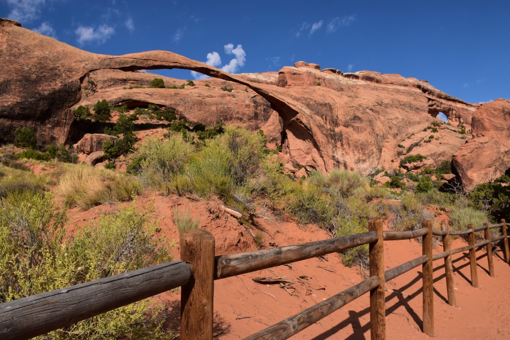
You’ll not only see the longest natural arch on earth, the Landscape Arch spanning 290 feet, but also seven others including Pine Tree Arch, Tunnel Arch, Partition Arch, Navajo Arch, Double O Arch, and Natural Arch.
If you only have time to complete one hike, I highly recommend this one as it has spectacular views with many of the iconic arches.
RELATED: A GUIDE TO
DEAD HORSE POINT STATE PARK
2. Broken Arch Loop
Elevation Gain: 59 feet
Distance: 2.3 miles
Difficulty: Easy to Moderate
Time: 45 minutes to 1 hour
Parking: Broken Arch parking lot.
Restrooms: Vault toilets nearby at campground.
Dogs: Not allowed on the trail.
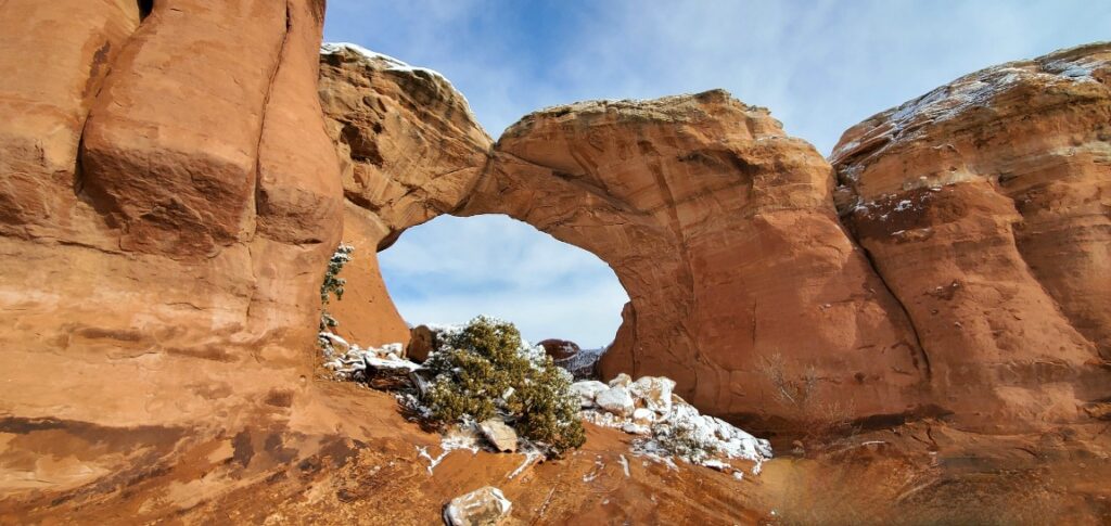
The Broken Arch trail begins at the southern end of the Devils Garden Campground.
It’s a relatively short and pleasant hike with a gentle incline to beautiful rock formations. If you want better views, scramble on up a few before heading downhill through a slot canyon.
A sandy section will then lead you to the fractured but lovely arch.
Another Option: You can extend the Sand Dune Arch Trail another 0.6 miles to the Broken Arch adding 1.2 miles total to that hike instead.
3. Skyline Arch
Elevation Gain: 30 feet
Distance: 1/2 mile
Difficulty: Easy
Time: 10 – 20 minutes
Parking: Alongside the road.
Restrooms: No vault toilets at trailhead.
Dogs: Not allowed on the trail.
This 1/2 mile out and back trail is short and sweet.
The flat path leads you right to the base of Skyline Arch where you can continue further up under the arch for an up-close look.
This area is a popular spot for visitors.
Visiting the Mighty 5 Parks?
Read Best Things to See in Zion National Park next!
4. Sand Dune Arch
Elevation Gain: 100 feet
Distance: 0.4 miles
Difficulty: Easy
Time: 15 – 30 minutes
Parking: Near the Devils Garden Campground at the northern end of the park.
Restrooms: Vault toilets near trailhead.
Dogs: Not allowed on the trail.
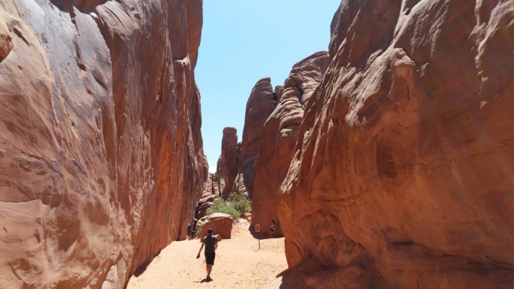
Sand Dune Arch is another easy trail and one of my favorite short hikes in Arches National Park.
After a short sandy trek between big rock walls on a narrow path, you’ll come to a secluded arch.
Since it’s usually in the shade, it’s a great option in the afternoon when other trails are hot.
5. Delicate Arch
Elevation Gain: 500 feet
Distance: 3 miles
Difficulty: Strenuous
Time: 2 – 3 hours
Parking: Wolfe Ranch Parking Lot (additional parking at the Delicate Arch Viewpoint parking lot but adds 1 mile to the hike.)
Restrooms: Vault toilets at the trailhead.
Dogs: Not allowed on the trail.
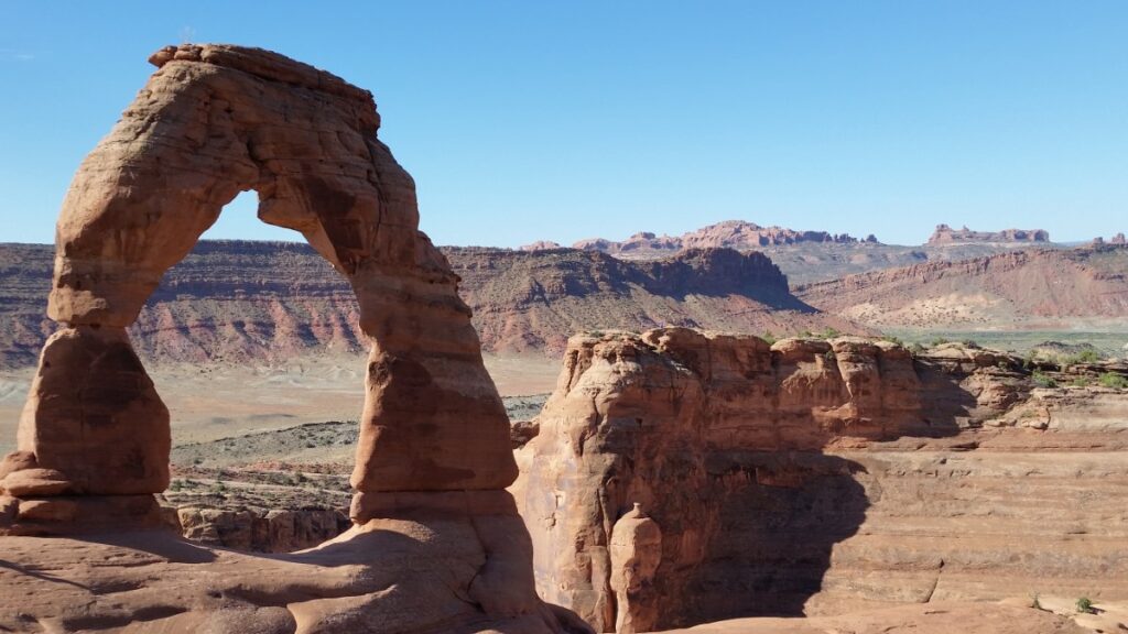
Delicate Arch, is the most iconic sight at Arches, making it the most popular trail also.
The hike begins with a steep climb along a clearly defined wide path.
Cairns will guide you along the next section on smooth rock (possibly slippery on a wet day) which eventually leads to a narrow rock ledge.
You’re rewarded for all your hard work once you reach the 46-foot arch, the largest free-standing arch in the park.
Tip: If you want to avoid large crowds, do not visit at sunset.
6. Windows Loop and Turret Arch Trail
Elevation Gain: 150 feet
Distance: 1.2 miles
Difficulty: Easy
Time: 30 – 45 minutes
Parking: Windows parking area.
Restrooms: Vault toilets at the trailhead.
Dogs: Not allowed on the trail.
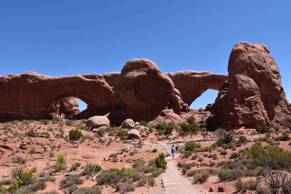
One of the most scenic areas of the park, the Windows section is home to the most concentrated number of arches and sensational views.
From the south side of the parking lot, a loop trail winds to the Turret Arch first.
You’ll figure out where the name came from when you see the tall tower-shaped rock next to the arch.
Continue around to the North Window and South Window.
Since the arches are part of the same sandstone fin, the “windows” are also called spectacles because from far away they resemble a pair of glasses with the Nose Bridge in the middle.
Complete the hike with a scramble to the South Window up on a cliffside.
LIKE ROAD TRIPS?
CHECK OUT THIS SUMMER NATIONAL PARK ITINERARY!
7. Cove of Caves and Double Arch
Elevation Gain: 275 feet
Distance: 1.1 miles
Difficulty: Moderate
Time: 30 – 45 minutes
Parking: Windows parking lot.
Restrooms: Vault toilets at the trailhead.
Dogs: Not allowed on the trail.
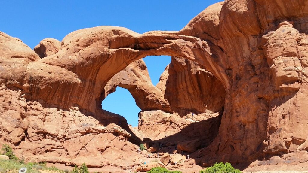
There’s so much eye candy in this section of the park! The Cove of Caves is an undefined backcountry trail that begins at the Double Arch Trailhead past the Parade of Elephants – a unique outcropping of rock formations.
The lovely desert landscape opens up to an unmarked trail that takes a little navigating to get to.
Download Google Maps or Navigator beforehand which will be helpful for traversing the area north to the Cove Arch.
Do Not Miss These Viewpoints
There are a few do-not-miss overlooks in the park also. Make sure to include them all on your visit:
- Fiery Furnace
- La Sal Mountains
- Garden of Eden
- Park Avenue
- Courthouse Towers


Leave a Reply