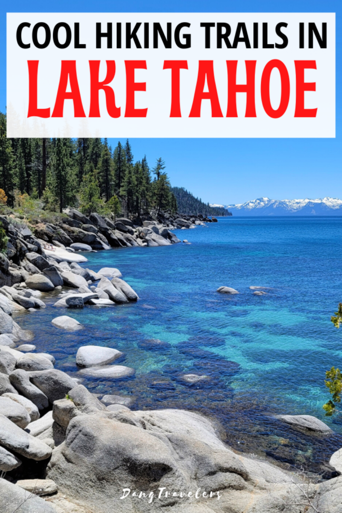
With over 100 scenic trails in the area, Lake Tahoe is a dream destination for hikers. Sitting at an elevation of 6,225 feet high, this jaw-droppingly blue alpine lake is surrounded by towering mountain peaks and pine trees galore. The lake has 72 miles of shoreline and every inch of it is simply stunning! Explore the crown jewel of the west on foot and put these Lake Tahoe hiking trails on your itinerary.
Lake Tahoe Hiking Tips
- Make sure to wear proper footwear when hiking. These men’s waterproof hiking shoes are waterproof and have a protective sole and these women’s breathable hiking shoes have a breathable mesh line with a contoured footbed. Or you can always go with a high ankle boot, check out these cute boots for women or these nice boots for men.
- Bring a good day pack for all your necessities including a small first aid kit.
- Since reception is usually spotty when hiking, download the Navigator Hiking app which works offline for maps and hiking trail information.
- Pack snacks and/or lunch depending on how long you’ll be hiking.
- To stay hydrated, always bring more water than you think you need and pack reusable water bottles to eliminate waste.
- Wear a hat and sunglasses and apply sunscreen beforehand.
- When hitting the hikes in Tahoe, please remember to leave no trace, stay on the trails and always pack it in and pack it out.
![]() Disclaimer: This post contains affiliate links, if you book through our link we will receive a small commission at no additional cost to you. Thanks for supporting the blog!
Disclaimer: This post contains affiliate links, if you book through our link we will receive a small commission at no additional cost to you. Thanks for supporting the blog!
Lake Tahoe Hiking Trail Map
1. Eagle Falls Vista Point Loop
Elevation Gain: 150 feet
Distance: .6 miles
Difficulty: Easy
Time: 20 – 30 minutes
Parking: Fee to park at Emerald Bay parking lot across the street and parking lot right at the trailhead, but free to park in spots along the highway.
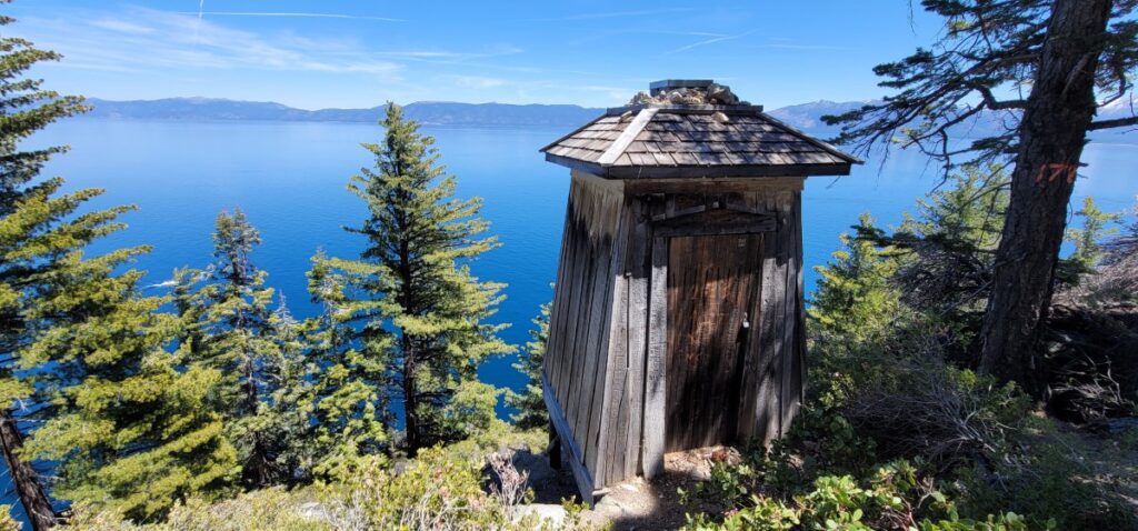
Restrooms: Vault toilets at the trailhead.
Dogs: Leashed dogs are allowed.
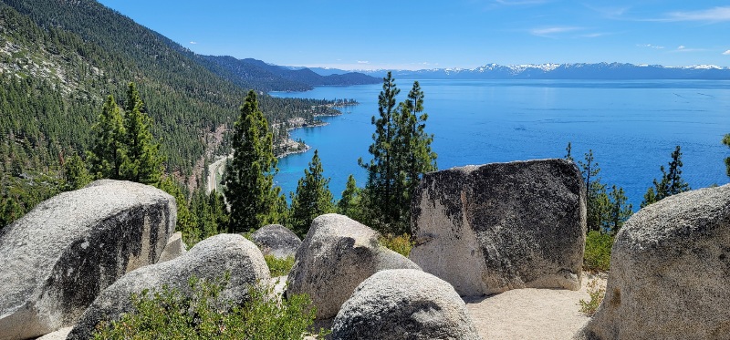
If you’re looking for hikes in South Lake Tahoe, the Eagle Falls Vista Loop is a very popular family-friendly trail because of its short length and easy accessibility.
Arrive early or late in the day to secure a parking spot.
The trail begins with a short climb to a rocky vista overlooking a pine tree-lined view of Lake Tahoe.
Then loop back down the stone staircase and veer off to the bridge for views of Upper Eagle Falls and Eagle Creek before finishing the loop.
If you are up for a bit of a challenge, I highly recommend continuing on to Eagle Lake for a beautiful alpine lake view. See below for details.
Hot Tip: Before or after the hike, make sure to adventure over to the lakeside right off the highway to see the top of Lower Eagle Falls plunging off the side.
2. Upper Meadow Loop
Elevation Gain: 50 feet
Distance: .8 miles
Difficulty: Easy
Time: 20 minutes
Parking: Free lot on the side of Mt. Rose Hwy
Restrooms: No restroom
Dogs: Leashed dogs are allowed.
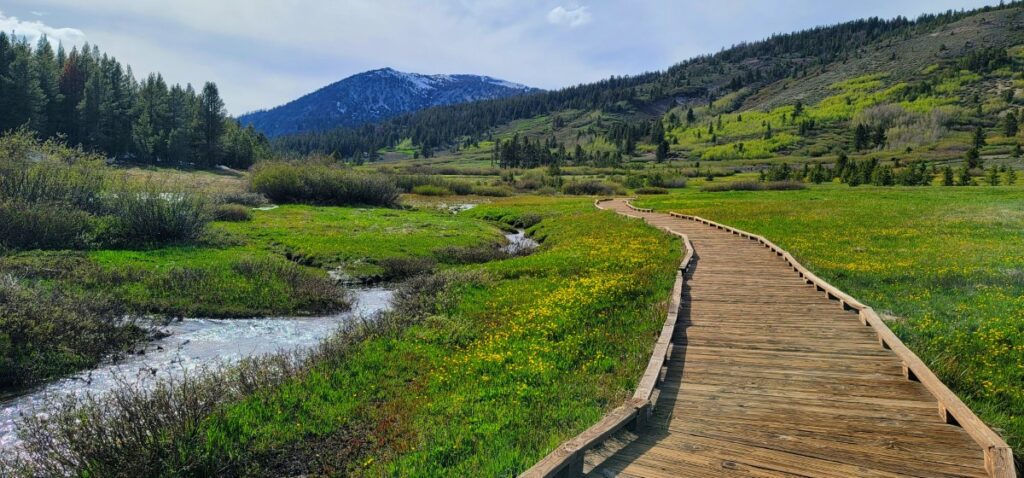
We happened upon the Upper Meadow Trail in West Tahoe Meadows by accident while driving the scenic Mount Rose Highway above Incline Village.
There are a few trails located at this trailhead that might be worth your time, but since we visited in early June the other two still had snow so we didn’t walk either.
The Upper Meadow Trail, however, is simply stunning. A wooden boardwalk lined with yellow wildflowers alongside a flowing creek guides you on a loop through the serene landscape.
3. Cave Rock Trail
Elevation Gain: 140 feet
Distance: .8 miles out and back
Difficulty: Easy
Time: 20 minutes
Parking: Limited free parking spots off Cave Rock Road near the trailhead and paid parking at Cave Rock State Park.
Restrooms: None
Dogs: Leashed dogs are allowed.
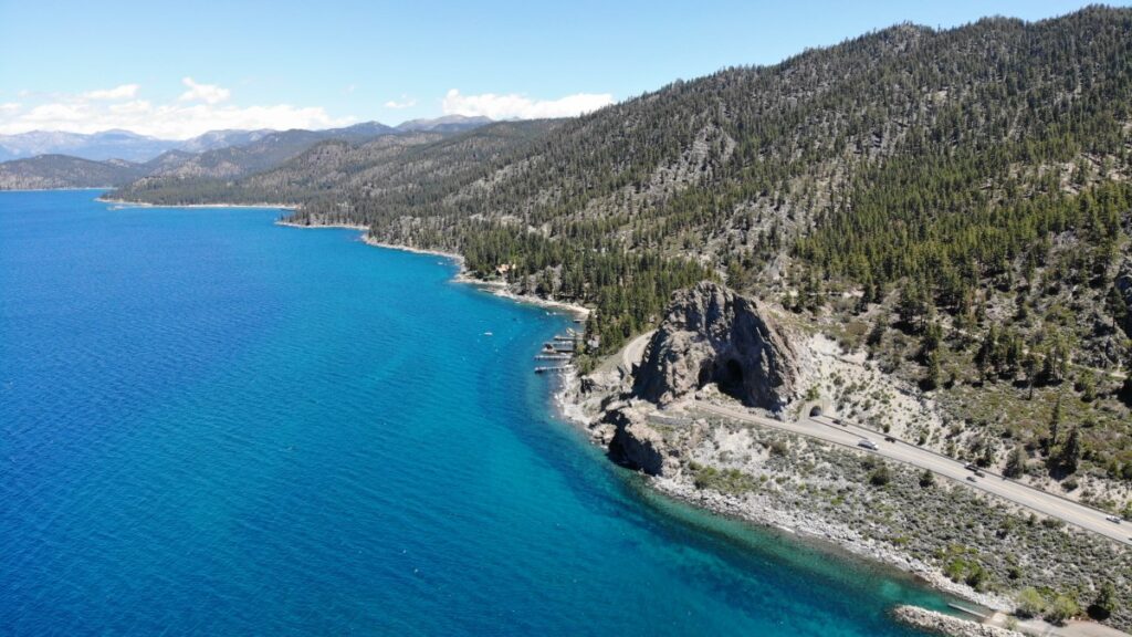
Located near Zephyr Cove above Highway 50, the Cave Rock Trail is one of the unique Lake Tahoe hiking trails in the area.
It’s easy, short, and to the point – climb a large rock for gorgeous views.
The trail starts out with a gradual climb on a wide dirt path until you reach the base of the cave rock. There, you’ll have a brief rock scramble to the top for an amazing vantage point of Lake Tahoe.
Lake Tahoe can get expensive here are Free things to do in Lake Tahoe in summer.
4. Tahoe East Shore Trail
Elevation Gain: 145 feet
Distance: 6 miles out and back
Difficulty: Easy
Time: 2 hours
Parking: Paid parking spots in three parking lots along the route.
Restrooms: Multiple vault toilets are on the path.
Dogs: Leashed dogs are allowed.
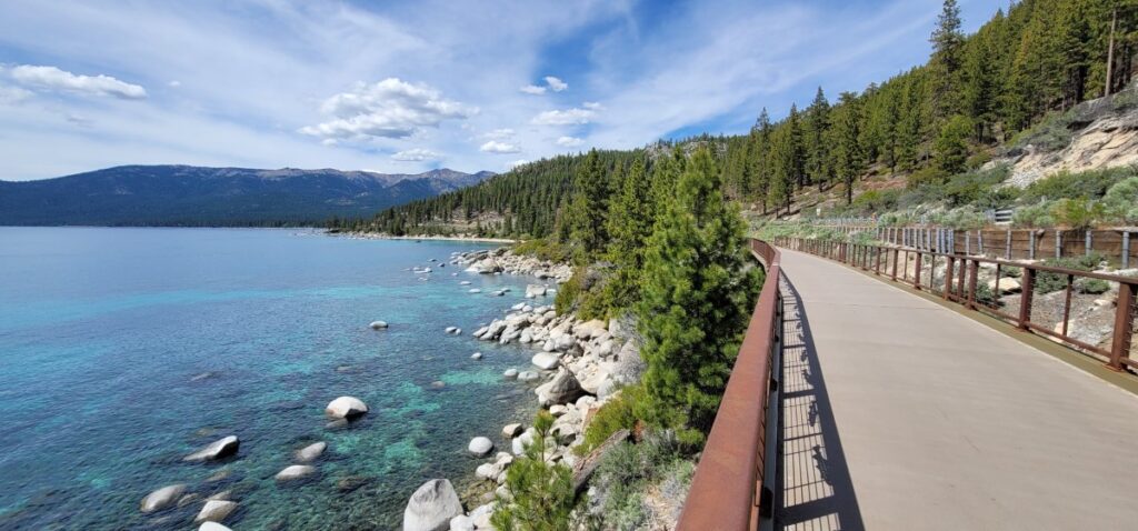
No wonder the Tahoe East Shore Trail has been called “America’s Most Beautiful Bikeway.”
The paved path begins near Tunnel Creek Cafe and ends at Sand Harbor following right along the turquoise waters of Lake Tahoe and leading to secret beaches and mesmerizing coves.
This trail is effortless and you won’t even notice the mileage while walking since the views are so sensational.
5. Chimney Beach Trail
Elevation Gain: 250 feet
Distance: 1.1 miles out and back
Difficulty: Easy
Time: 1 hour
Parking: Free parking at the trailhead off Highway 28.
Restrooms: Vault toilets are located near the parking lot.
Dogs: Leashed dogs are allowed.
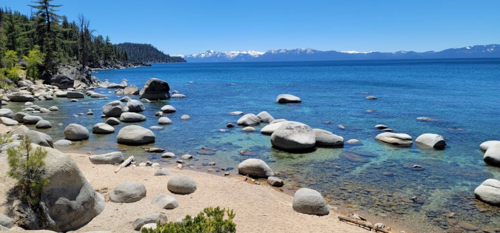
One of the popular north Lake Tahoe hiking trails is the Chimney Beach Trail. It is short and sweet and a spectacular treat.
The dirt forested path takes you down via a handful of easy switchbacks to a few sandy coves on the eastern shore of Lake Tahoe.
The turquoise water is magical and this is the perfect place to hang out for a few hours on a sunny day.
At the northern edge of the beach, you’ll notice a stone fireplace with a chimney, hence the name, standing alone on the sand.
It’s a unique landmark leftover from an old cabin back in the day!
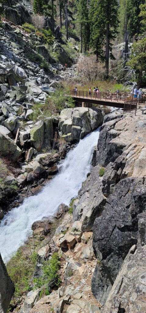
6. Cascade Falls Trail
Elevation Gain: 150 feet
Distance: 1.5 miles out and back
Difficulty: Moderate
Time: 45 minutes – 1 hour
Parking: Fee to park at Bayview Campground, but free on Highway 89.
Restrooms: Vault toilets at the trailhead.
Dogs: Leashed dogs are allowed.
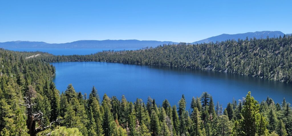
The Cascade Falls Trail is one of the Lake Tahoe hikes with waterfalls. You’ll start your short hike at the back of Bayfield Campground.
The trail is very straightforward with a gentle climb alongside Cascade Lake with views almost the entire way.
Once you reach a large rock outcropping, you lose the easy-to-follow trail, but if you just follow the sound of water, you’ll find yourself at the top of Cascade Falls.
It’s another popular trail in the area for good reason, it’s relatively short with fantastic rewards.
7. Eagle Lake Trail
Elevation Gain: 460 feet
Distance: 2 miles out and back (roughly another .4 if you combine it with the Eagle Vista Loop Trail)
Difficulty: Moderate
Time: 1 1/2 to 2 hours
Parking: Fee to park at Emerald Bay parking lot across the street and parking lot right at the trailhead, but free to park in spots along the highway.
Restrooms: Vault toilets at the trailhead.
Dogs: Leashed dogs are allowed.
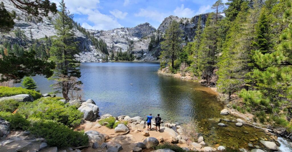
The Eagle Lake Trail is a continuance of the Eagle Falls Loop trail.
Once you reach the bridge overlooking Upper Eagle Falls and Eagle Creek, continue the climb with views of granite peaks, giant boulders, and lush vegetation.
Your journey ends at the crystal-clear picturesque Eagle Lake surrounded by rugged rock outcroppings sprinkled with snow interspersed with bright green pine trees.
Fill out a free day-use Desolation Wilderness permit before beginning the hike located at the trailhead near the big sign.
8. Monkey Rock
Elevation Gain: 500 feet
Distance: 2.5 miles out and back
Difficulty: Strenuous
Time: 1 1/2 to 2 hours
Parking: Near Paid lot near Tunnel Creek Cafe or free parking on the road
Restrooms: Porta potty on Highway 28
Dogs: Leashed dogs are allowed.
Come for the monkey, stay for the views!
Rumor has it, that a local going through a divorce from Incline Village climbed up one day and carved a mouth and eyes into the large granite rock already resembling a monkey.
I don’t condone defacing nature, but since it’s already done and looks pretty neat, I suggest you take the hike to go see it. Plus, the views are second to none. Monkey Rock is one of the best hikes in North Lake Tahoe for sure.
It begins on an old gated forest road near Tunnel Creek Cafe (a really nice cafe by the way, that would be good for before or after the hike for a coffee, sandwich or a snack) that leads to the Spooner Backcountry.
The trail splits off about 3/4 of a mile into the hike, where you’ll follow left and continue to climb.
At this point, you’ll see a super steep shortcut on the left side that’s roughly .1 mile straight up or you can continue on for a more gentle climb but adding more steps to your hike.
We chose to take the shortcut and even though we huffed and puffed all the way, it is doable.
Once you reach the top, you’ll be rewarded with panoramic views of Lake Tahoe and Mr. Monkey Face!
We turned this hike into a loop by turning left at the split-off (you’ll see a battered brown sign) we mentioned earlier on the way back down. It’ll take you to Highway 28 where you can hop on the East Shore Trail (read more on that below).
Out of all the Lake Tahoe hiking trails we took, the views from Monkey Rock were one of our favorites.
Note: You won’t see any signs for Monkey Rock, only for the Flume Bike Trail but rest assured you’re on the right trail.
9. Rubicon Point Lighthouse Loop Trail
Elevation Gain: 500 feet
Distance: 2.5 miles
Difficulty: Moderate
Time: 1 to 1 1/2 hours
Parking: $10 Fee to enter D.L. Bliss State Park
Restrooms: Inside the state park near the beach and campground.
Dogs: No dogs are allowed on trails.
D.L. Bliss State Park is quite the state park. With lovely beaches, a nice campground, a balancing rock, and a few memorable trails, you’ll be quick to figure out why it’s so busy.
The Rubicon Point Lighthouse Loop will not only lead you to one of the highest lighthouses in North America standing at 6,300 feet (1,900 meters) but supply you with impressive views of Lake Tahoe also.
You can begin the loop halfway down to the beach or at Calawee Cove. I highly suggest taking whatever parking spot you can find and start from there.
On your visit to Lake Tahoe, you’ll be near one of the Top National Parks in the United States.
10. Echo Lakes Trail
Elevation Gain: 511 feet
Distance: 5.3 miles out and back
Difficulty: Moderate
Time: 2 to 2 1/2 hours
Parking: Lot near Echo Lake Chalet
Restrooms: Vault toilets are located near the parking lot.
Dogs: Leashed dogs are allowed.
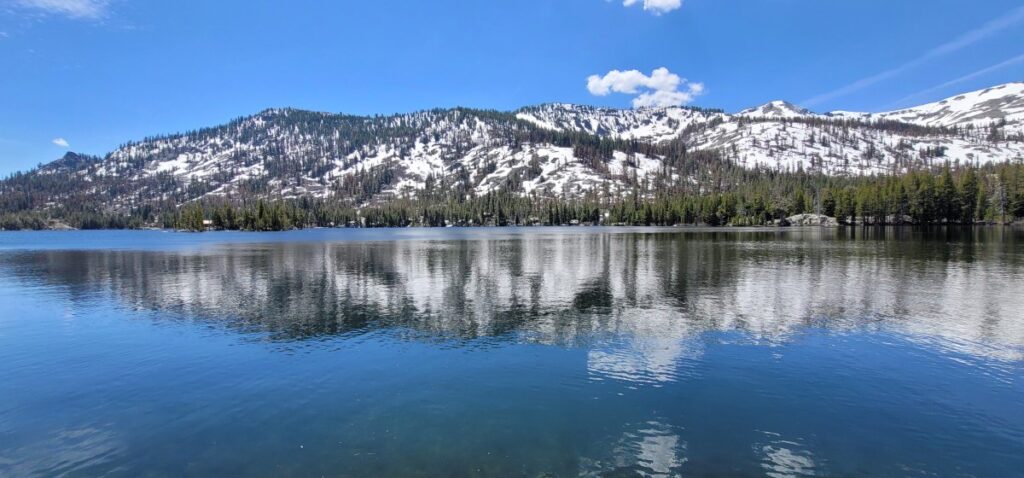
One of the other interesting hikes in South Lake Tahoe is the Echo Lakes Trail.
Start your day at the Echo Chalet (only open during the summertime) at Lower Echo Lake, where you can grab a quick bite to eat and drink before or after your walk.
A gentle climb takes you to the trail that follows the northern edge of the lake providing steady views of the lake and the cabins on the lake almost the entire time.
It’s exciting to think you’re on a section of the Pacific Crest Trail; it is supposedly the second easiest section of the entire PCT since it’s relatively flat.
Head into the woods for a short time before popping out near Upper Echo Lake. There aren’t many open views of the lake so suggest looking for the sign that says “Taxi” on the trail and head to the pier for up-close views of the water.
For a small fee, you can typically take a boat taxi back from the pier during the summer months if you’d like to shorten your hike or get out on the water. Check here to see if the Echo Lake Taxi is currently running.
11. Rubicon Trail from D.L. Bliss to Emerald Bay
Elevation Gain: 1,000 feet
Distance: 7.3 miles out and back
Difficulty: Moderately strenuous
Time: 3 to 4 hours
Parking: $10 Fee to enter D.L. Bliss State Park
Restrooms: Inside the state park near the beach and campground.
Dogs: No dogs are allowed on trails.
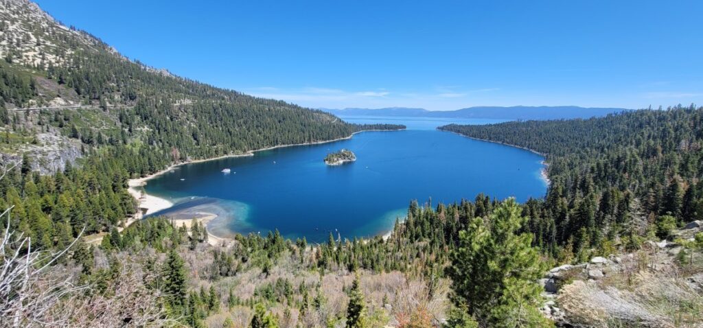
This section of the Rubicon Trail covers some of the most eye-catching sights in Lake Tahoe walking along the water’s edge from D.L. Bliss State Park all the way to Emerald Bay State Park. Or vice versa.
On the trail, you’ll be astounded by outstanding views of the lake. There’s a good chance you’ll see eagles or ospreys and you’ll definitely spot a few kayakers and boaters.
Other highlights include Emerald Bay Beach where you can float in the crystal clear water, Lower Eagle Falls, a splendid cascading waterfall, and Vikingsholm, a 38-room Scandinavian-inspired mansion at the base of the bay.
Frequently Asked Questions
What part of Lake Tahoe is best for hiking? This depends on what type of hiking you are looking for, both the South and North ends of Lake Tahoe offer an array of hikes from easy to difficult.
Is Lake Tahoe good for hiking? Yes indeed, Lake Tahoe is the perfect destination for hiking. There are at least 100 trails in and around the area.
Is there a trail that goes all the way around Lake Tahoe? Yes, the Lake Tahoe Rim Trail is 165 miles long and loops around the entire lake.
Renee Cailloux
Thank you! Honestly, that’s all I can say. I have always issues choosing shoes and I clicked on the link for cute boots, looked at the reviews and ordered them. They are perfect. Thanks for your help! 🙂
Dang Travelers
You are so very welcome! Happy hiking!!